Views
From DMCB Wiki
(Difference between revisions)
m |
m |
||
| Line 28: | Line 28: | ||
== References and Resources == | == References and Resources == | ||
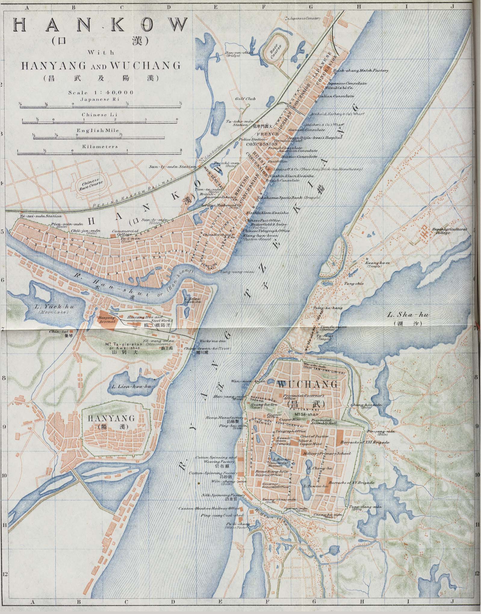
| - | * [http://lib.utexas.edu/maps/historical/hankow_1915.jpg Map of Hankow with Hanyang and Wuchang], published in Japan in [[1915]] | + | * [http://www.lib.utexas.edu/maps/historical/hankow_1915.jpg Map of Hankow with Hanyang and Wuchang], published in Japan in [[1915]], Perry-Castañeda Library Map Collection, University of Texas at Austin |
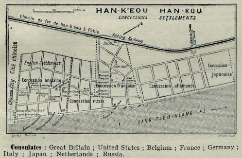
| + | * [http://www.lib.utexas.edu/maps/historical/han_keou_1912.jpg Map of Hank'eou], [[1912]], Perry-Castañeda Library Map Collection, University of Texas at Austin | ||
[[Category:Geography]] | [[Category:Geography]] | ||
Revision as of 22:10, 22 April 2010
Hànkǒu 漢口
|
 |
| Nearby Locations: |
| Central China Region |
 |
Hànkǒu 漢口 was settled as a center of merchant activity in the Míng dynasty, nearby to the older and more established cities of Hànyáng 漢陽 and Wǔchāng 武昌. In the late Qīng, the city was opened to foreign powers as a treaty port. After the First World War, the Chinese government reclaimed the German and Russian concessions, and the British left during the anti-imperialist movement of 1927. Later that year the Northern expedition occupied the city, and in 1928 the three cities were merged into Jīngzhàoqū 京兆區, popularly known as Wǔhàn 武漢.
Contents |
Important Buddhist Sites
- The Hànkǒu Buddhist Association 漢口佛教會 was founded here in 1920. It was later reformed as the Right Faith Society 正信會 in 1928.
- Huáyán University 華嚴大學 was founded here in 1920 by Cízhōu 慈舟 (1877-1958)[1]
Other Notes
- Right Faith 正信, later called Right Faith Weekly 正信週刊, was published here in the 1930s and 1940s
- The Young Men's Buddhistic Monthly 佛化新青年 was published here for the first 5 issues
- Wáng Sēnfǔ 王森甫 was born here in 1881
Notes
References and Resources
- Map of Hankow with Hanyang and Wuchang, published in Japan in 1915, Perry-Castañeda Library Map Collection, University of Texas at Austin
- Map of Hank'eou, 1912, Perry-Castañeda Library Map Collection, University of Texas at Austin